Vaisala IRIS Focus Remote Sensing Software
The next generation remote sensing.
Making the most out of your remote sensors
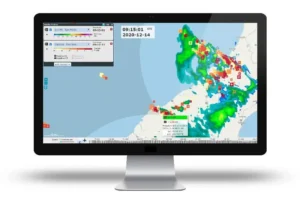
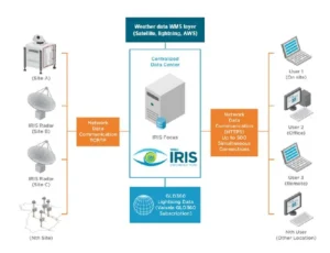
With the increasing frequency and severity of extreme weather events due to climate change, understanding ever-changing meteorological phenomena is crucial in order to anticipate potential risks to people, activities and goods. Having the ability to quickly analyze detailed weather data and generate real-time weather-related alerts to take well-informed decisions is stronger than ever. With IRIS Focus, Vaisala is leading the evolution of remote sensing software while combining data from Weather Radars, Wind Lidars and Lightning at a glance. The software provides the user with a comprehensive view to help better understand weather hazards such as storms, windshear, turbulence, precipitation and more, for:
- Earlier extreme weather and storm predictions and analyses
- Quicker decision-making for events that may impact your environment
- More accurate precipitation classification
Faster data analysis
IRIS Focus offers new ways of observing data for better characterization and understanding of weather hazards, storm tracking and lightning classification. IRIS Focus includes a suite of products that are available on-demand. This allows the users to get more out of their data by having the ability to configure the product parameters and visualization details to suit their needs.
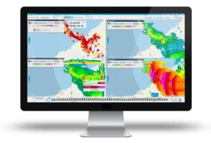
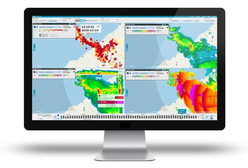
By way of the multi-panel display, users can integrate various data sources from one or multiple remote sensors (Weather Radars, Wind Lidars or Lightning) and have the option to overlay within one view or separate the products in up to four individual windows. Such function allows the user to visualize the data together all at once. Designed with the user in mind, IRIS Focus provides various easy-to-use functions, including storming tracking, nowcasting, and the cross-section tool, to enable better understanding of storm movement and structure for more accurate forecasts and earlier watches and warnings.
Advanced decision-making
IRIS Focus provides the user with an elevated capability for decision-making when it matters most. From combining various weather datasets to determine storm cell centers to offering a full suite for alerting/notification, IRIS Focus does it all.
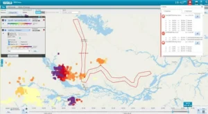
- Configure events/alerts with specified alarm conditions for each area of interest with lightning data, weather radar data, or both.
- Automatically detect weather hazards as they appear
- Create your own areas of interest with user-specified shapes, as well as areas of interest relative to customer-supplied assets.
- Receive a notification when a significant weather event appears in your area of interest — even on your mobile device by way of email or SMS notification.
Access anywhere
Completely designed with the end-user in mind, IRIS Focus is a web-based software that lets whoever easily access and share data whenever, wherever, and on whatever device of choice.
- Save your frequently used views so that they are available each time you arrive to work
- Share your data for easier distribution with colleagues in other departments and outside of your agency
- Optimize your user base by defining which users have elevated credentials to fully manipulate the web interface, and which ones can be afforded simplified access for data viewing
- Historical data browsing is available to allow the user to look at previous weather events
IRIS Focus for Aviation
Extreme weather is growing in frequency and intensity with climate change, making it more challenging and more important to understand and anticipate weather hazards. Air traffic controllers, meteorological observers and other airport decision makers need to make fast, well-informed decisions with the ability to quickly analyze detailed weather data and generate real-time weather alerts. With Vaisala IRIS Focus, you gain a superior understanding of storms, windshear and turbulence for safe and efficient take-offs and landings. IRIS Focus combines data from remote sensors including weather radar, wind lidar, lightning precision networks and other data sources like satellites to provide an interactive visualization of weather data.
Product Resources
| Document Title | Download |
|---|---|
| IRIS Focus Weather Radar Software | Download |
| IRIS Focus Remote Sensing Application Software | Download |

